
ARCHEOLOGICAL WORK IN HAWAIIToC
INTRODUCTION
The ethnologist or archeologist desiring to conduct explorations on the Hawaiian Islands will find it necessary to begin his labors at the Bishop Museum in Honolulu. This museum contains an extensive collection of articles, classified, arranged, and labeled, illustrating every phase of native life as it has existed since the islands have been known to white men, as well as many of the implements and objects pertaining to agriculture, fisheries, and domestic occupations of earlier times. Models or casts of houses, and of individuals engaged in various lines of industry, give the visitor a clear idea as to the routine of ordinary daily life. A careful study of all these things enlightens him in regard to what he may expect to find and to the meaning of such discoveries as he may make.
The extensive library which belongs to the museum contains every publication relating not alone to the islands but to all the archipelagoes of the southern Pacific that it is possible to procure; and among the most valuable of the volumes are the reports and memoirs of the museum itself, in which are set forth the observations and deductions of numerous investigators who, either in behalf of the museum or under its auspices, have endeavored to find a solution for the many problems involved.
Equally valuable to the student are the information, interpretations, and instruction freely placed at his disposal by those connected with the museum, especially by Dr. Brigham, the former director, whose long and busy life has been devoted almost entirely to a study of the Polynesian groups; by Professor Gregory, the present director, who with tireless energy is the impelling force behind various lines of scientific research; by Mr. Stokes, curator of the ethnological department, who for more than a score of years has been surveying, photographing, and collecting in every part of the islands; by Mr. Thomas G. Thrum, of Honolulu, who has completed, in manuscript, a volume containing a list and description of more than 500 heiaus on the islands; and by various other men who, in private life, have devoted much time and close attention to whatever may pertain to native life and customs.
[175]
MOLOKAI ISLAND
Following the advice of those whose knowledge gave them authority to speak decisively, the initial base of research was the island of Molokai, which presents the best conditions for study. It lies off the usual lines of travel, offers no inducement to tourists who wish to have the benefit of good roads and comfortable hotels, and consequently is seldom visited except by those who are called on business or who go as the guests of the few residents there.
Mr. George Cooke, one of the owners of a large cattle and sheep ranch on the island, and greatly interested in its aboriginal history, gave most generous aid in a reconnoissance of such parts as he had time to visit. He placed his beautiful summer residence at the disposal of Prof. Gregory and the writer, and conducted the explorers to nearly all the places of interest which could be approached by automobile. Mr. James Munro, manager of the ranch, also rendered valuable assistance. Owing to his long residence here he has become thoroughly familiar with every noteworthy feature, and pointed out many remains which, without his guidance, would have been missed altogether. Fully acquainted with the life of the Hawaiian people, he made clear the origin and purpose of many things that, lacking his intelligent explanation, would have been without significance.
Although there are now comparatively few Hawaiians on Molokai, it is evident that the island at one time supported a dense population. Along the southern, or leeward, coast are numerous fish ponds formed by building a stone wall across an inlet or, more frequently, by constructing it with the ends on shore and carrying it around a section of the open sea. The walls are strong enough to resist the waves, well above the level of high tide, and surround spaces of various areas up to 70 acres. These ponds were stocked with numerous kinds of fish which, thus protected from their natural enemies, increased rapidly and formed an unfailing food supply. The antiquity of these ponds is denoted by the amount of silt partially filling them, brought down from the mountains by erosion of the soil. They are still used to some extent by Hawaiians as well as by other residents.
Inland, low walls of stone or earth, or both, surround hundreds of old taro patches, one variety of these plants requiring an abundant supply of water during its growth. The poi made from taro was the principal vegetable food of the inhabitants. Sweet potatoes were also a leading article of diet. The fields in which they were grown may still be identified here and there by the little ridges heaped up. All these, with the addition of migratory birds and fowls which at certain seasons swarmed on the different islands, supplemented by various nuts and fruits growing spontaneously, provided a varied and ample food supply. Mammals, except the pig, dog, and rat [176](really a large mouse), which came in with the early natives, were unknown prior to the advent of the whites. There were no land reptiles and few indigenous noxious insects; although mosquitoes, not to mention certain domestic pests, abound in a few places, and there are some scorpions and centipedes; but these, like measles, smallpox, tuberculosis, and worse diseases, are adjuncts of an enforced civilization. The mongoose, brought in to destroy rats, and the myna bird, to devour insects, are themselves now beginning to be detrimental.
Along the coasts, on the headlands and lower hills, and to a less extent farther inland, are village sites, foundations of temples and houses, garden patches inclosed by stone walls, and long rows of stones, some of which are borders of roads or trails, others being for purposes which are undetermined. Among these, taro beds and sweet potato patches may still be traced.
The most remarkable among the remains are the great temple site on Senator Cooke's ranch, toward the east end of the island, and the "paved trail" 10 miles down the coast from Kaunakakai, the principal village and harbor. The former is rectangular in outline, built on irregular ground, of stones large and small, to form a level platform on which a thousand persons could assemble without being hampered for lack of room. The outer faces of the walls vary from 3 to 20 feet in height; and except at the lowest parts there are terraces or steps all around, about 5 feet in height and of differing width. Surrounding this platform, extending for half a mile up the little valley of which it marks the entrance, on the slopes to either side, and on the nearly level area reaching down to the sea in front, are all the indications of a populous settlement.
It is said that the ruins were formerly much more numerous and extensive, the larger part of them being swept out of existence by a great rush of water from the mountains "a long time ago."
The "paved trail" is a causeway of large stones. Some parts of it are obliterated by slides and encroaching ravines; other parts preserve the original condition and appearance. The width is not quite uniform, as the stones are of different sizes, but it departs very little either way from 6 feet. So far as can be judged in its present overgrown state, it extends in a straight line for about 2 miles, from the beach to a point on the hill at an altitude of fully 1,000 feet. To what it led, or why it was built, are questions awaiting an answer.
All of these places are now abandoned except a few villages along the coast. The people are not here to occupy them, and even if they were the conditions have become so changed that residence about them is no longer feasible. At the temple site, for example, the extent of the old taro beds predicates an abundance of water; at present, the one family living near by must carry it in a dry season [177]from the well or spring of a neighbor. There is no steady water supply within miles of the "paved trail."
Clearly, extensive changes have taken place in recent times in climate and perhaps in topography. Fifty years ago forests of large trees grew over hundreds of square miles on the southern slopes of Molokai where at the present time there is only grass, or where algaroba trees, similar to the mesquite of the southwestern United States, are now spreading. This deforestation is still going on; dead or dying trees fringe the timber still standing. The cause of this progressive barrenness has not, so far, been, fully ascertained; there is undoubtedly a connection between it and the diminished water supply, though which is cause and which is effect, or whether both are due in common to some atmospheric phenomenon, is unknown. One result, however, is apparent. The roots of the forest trees do not extend deep into the earth, but spread out over the surface like those of pine trees. Thus much of the rainfall was prevented from escaping rapidly and such as was not absorbed by the roots made its way into the ground beneath the upper soil, whence it percolated downward to feed the springs. Now the greater part of the water runs off and is lost. For this reason large areas once well populated are no longer habitable.
Molokai, like other islands of the group, contains no stone except of volcanic or coral formation. There is no chert or similar material from which chipped implements can be made; nor, as would naturally be expected, is there any obsidian suitable for such manufacture. It may occasionally be seen on the sites of villages, but always in small angular fragments seldom more than half an inch in any dimension, always coarse-grained, even porous, and never of a quality which can be flaked into definite forms. No doubt its only use was as an abrasive, after being pounded fine. Rarely, quartz or chalcedony is found; it resembles the deposit around hot springs or in fissures, and, like the obsidian, is in fragments too small to be utilized except as a grinding or polishing material for smoothing wrought objects.
Manufactured stone specimens are confined principally to three general classes: Adzes, for working in wood; pestles, for pounding the taro root; and discoids, for games. The last are exactly similar to the chunkey stones so abundant in the States, except that none of them have concave or hollowed faces, and they are used in the same way. There were three forms of the game: To hurl or roll a disk farther than an opponent; to strike a pole or other mark set up; and to test the inherent magical powers of the stones by rolling them in such a way that they would collide, the object in this case being to see which one might prove victorious by breaking the other or forcing it out of its course. A suitable arena for the contest was prepared by [178]carefully leveling and smoothing a straight, narrow strip of ground to any length desired, a slight wall being thrown up along each margin.
Pottery was unknown, there being no clay suitable for making it. Calabashes or gourds and wooden trays served as receptacles, though stone dishes or bowls are sometimes found. Along the coast occur sinkers, either plummet-shaped or half-ovoid like an egg divided lengthwise. This form has a groove around the longer diameter, crossing the flat face, and was tied to a white shell as a sinker in catching squids or cuttlefish, a hook being attached to the line. Coral was much used as files or rasps. There are a few objects whose purpose is problematical; and some highly polished black disks which, laid flat and covered with a film of water, make excellent mirrors; but aside from what is here mentioned, not much worked stone is found. Wood, bone, and shell served as the raw material for nearly all other needs.
Graves, or what are supposed to be graves, marked by cairns 3 or 4 feet high, or perhaps by only one or two layers of stones, are found, though rare. Many so-called caves—which are merely "tunnels," "bubbles," or "blow-holes" in the lava—were utilized as burial vaults. The natives vigorously protested against an attempt to excavate any of these, claiming that their ancestors or members of their families are buried in them and must not be disturbed. In the dunes human skeletons are frequently exposed by the shifting of the sands by the high wind. The natives seem to have little regard for these. Perhaps they are of the "common people," while cairns cover the chiefs or priests. There is a tradition that in "the old times" most of the dead were cast into the ocean as an offering to the Shark God.
There are no mounds or other structures of earth; everything was built of stone. All structures began at the surface of the ground. No evidence has been found of an occupation earlier than that of the present Hawaiian people. At no point examined in ravines or cliffs was there the slightest hint of human life at a period antedating that beginning with the race discovered by Captain Cook. Consequently no extended excavations were attempted. The results of some examinations made in three different places will be presented.
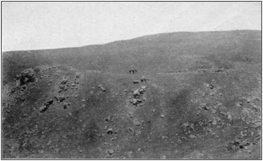
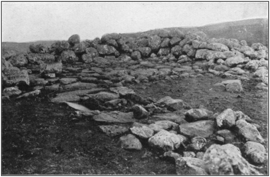
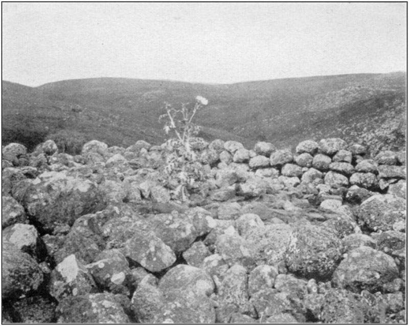
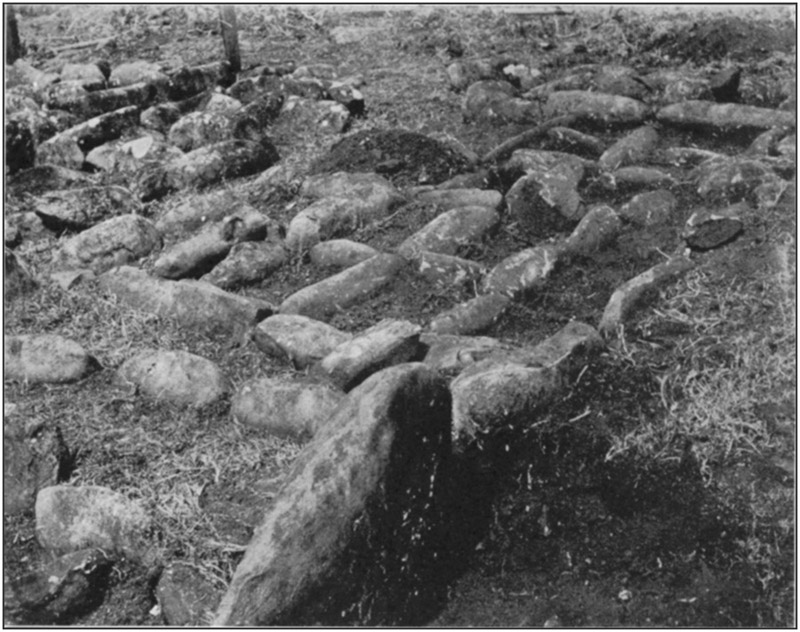
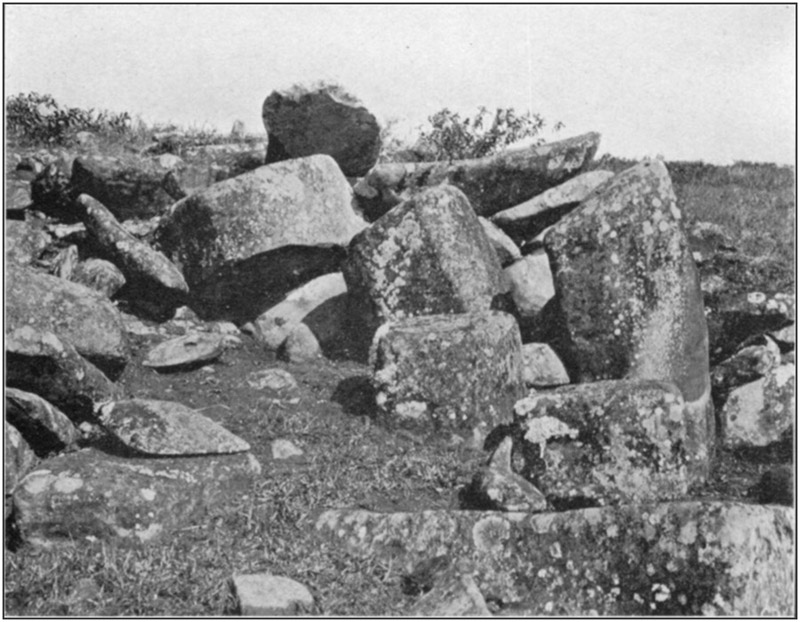
About 10 miles in an air line from Kaunakakai and the same distance from Mr. Cooke's home, on a mountain known as Mauna Loa, is a narrow, sharp ridge extending nearly south and terminating abruptly at the junction of two deep ravines. On the end of this are two house sites, or heiaus, which had never been disturbed. They are as nearly rectangular as the irregular stones of which they are built will permit. The larger (A) has its south wall at the edge of the low cliff, with its sides nearly on the cardinal lines. [179]Omitting inches from the measurements, its outer dimensions are: North wall 38 feet, south wall 32 feet, east wall 33 feet, west wall 32 feet. The corresponding inside measurements are 21 feet, 19 feet, 21 feet, and 22 feet. Thirteen feet north from the north wall is a stone pile 13 feet north and south by 10 feet east and west, 18 inches high. Ten feet west of this is a single layer of stones covering an area 7 feet east and west by 4 feet north and south. At 9 feet out from the middle of the west wall is a platform 7 by 7 feet, its west edge on large stones in place. At the west end of the north wall are three large flat stones, one of them forming the corner, the two others west of this, the three being up-edged and in a continuous line.
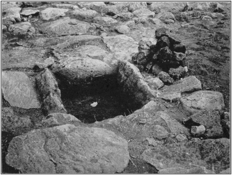
Within the inclosure, at the southern end, is a closely laid pavement formed of a single stratum of loose stones, laid on the earth, and covering a space 20 feet east and west by 10 feet north and south. Along the inside of the wall, at the northeast corner, is a similar pavement 12 feet north and south by 4 feet 6 inches east and west, and a foot high. Both of these pavements were probably intended for seats and beds. On the larger pavement, 5 feet from the south wall, 9 feet from the east corner, was a boulder, its diameters 11, 12, and 15 inches, whose largest surface lay uppermost and was hollowed out to form, a deep saucer-shaped depression like a mortar; but as there was nothing to grind, it was probably to crack or pound nuts in. At the middle of the southeast quarter of the inclosure was a pile of stones 3½ feet across and 1 foot high; there was nothing under them. Seven feet from the north wall, 10 feet from the east wall, was a fireplace formed of two slabs on the east and west sides and a flattened boulder on the south side, all upedged, the north side being left open. Its bottom was undisturbed earth, a foot lower than the level of the platforms. It would seem, though this is uncertain, that the platforms or pavements were on the original surface level, the unpaved space being cleared out to the level of the bottom of the fireplace, and that this space had been filled with earth blown in by the winds after the spot was abandoned. From outside to outside the upedged stones measured 26 by 28 inches; the space inside 18 by 20 inches. On the west edge was a large grinding stone, the amount of wear on its surface indicating much use. A pavement 4 feet wide reached from the open side of the fireplace to the north wall.
In the cavity was about half a bushel of small stones, most of them burned. When meat was to be baked, a fire was made in the pit and as many of the stones as required were heated; they were placed in the body cavity, in the mouth, and in slits cut in the skin of the animal, which was then deposited in the pit, closely covered, and left until thoroughly cooked. Similar ovens or barbecue holes, and [180]the same method of cooking, are still in use among the natives in their villages.
Views of this house site and of the fireplace, taken from various directions, are shown in plates 38-40.
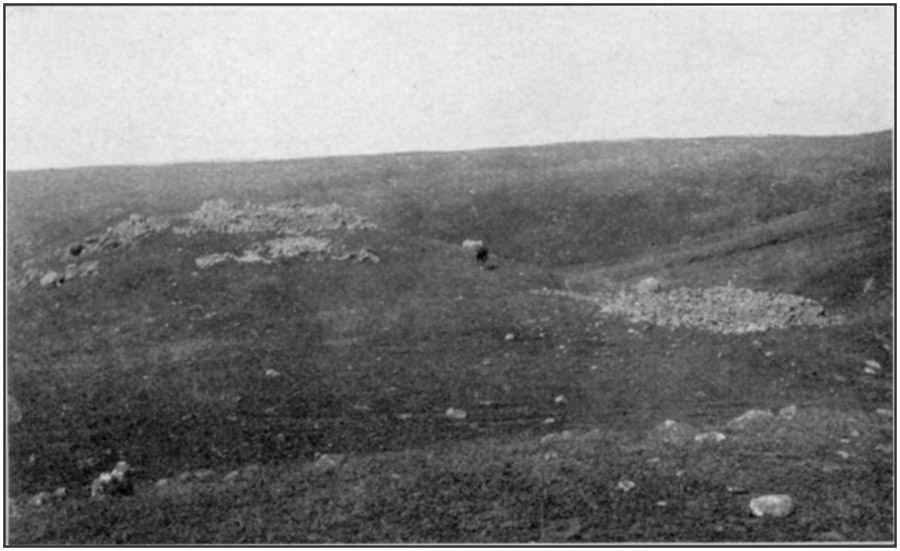
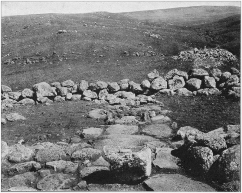
Nearly north of the house site (A), at a distance of 91 feet, is the similar structure (B). The ground on which this is built is 6 feet lower than at (A). Its measurements are 23 by 24 feet outside, 13 by 18 feet inside, longest north and south. The entire interior is paved. For a space of 8 feet from the north end the pavement is a foot higher than in the south end. Beginning at the foot of the south wall, on the outer side, and extending for 29 feet toward (A), there is a closely laid stone pavement 10 feet wide at the wall and gradually diminishing to a width of 5 feet; its termination is nearly square, the slight curve being apparently not intentional. The west edge of this pavement is in a straight line, the east edge being curved.
Partial views are given in plate 41.
Neither (A) nor (B) has any opening for a doorway, nor is there any apparent method of easy entrance, though a slight platform on the north side of (A) may have supported steps of wood.
These walls, as in all other heavy structures observed, were made by carefully laying up two rows of large stones at a little distance apart and filling the space between them with stones of any convenient size, thrown in at random. Timbers set in them formed the skeleton structure of a house which was completed of poles and smaller growth, the sides and roof being thatched. The weight of the stones held the main timbers against the force of the wind even in severe storms.
The surface over hundreds of acres around these ruins is covered with house sites, long straight rows of stones, and garden lots surrounded by stone walls. Shop refuse, mostly chips and spalls from adz making, sea shells broken to extract the mollusks, coral for abrading, adzes in all stages of finish, and many "olimaikis" (chunkey stones) are found. A mile away is a chunkey yard or bowling alley about 600 feet long on the crest of a ridge which overlooks the ocean on both sides of the island.
THE RAIN HEIAU
A mile from the Cooke residence is a peculiar structure, said to be the only one of its kind in the entire Hawaiian group. Native tradition has it that "a long time ago" a rain wizard who was angered by the people of this district sent such rains that everything was on the point of being washed out to sea. Another wizard told the people to make a heiau (temple, or sacred building) with many [181]small compartments which were to be left uncovered in order that the raindrops, each of which was as large as a man's head, could be caught and held in them, and burned. The rain would cease when the first wizard learned that he was being circumvented.

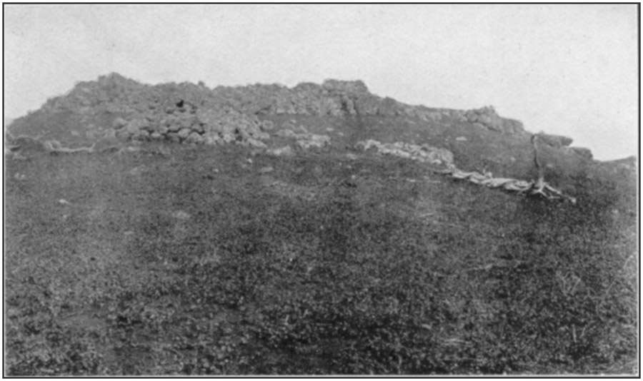
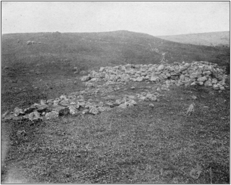
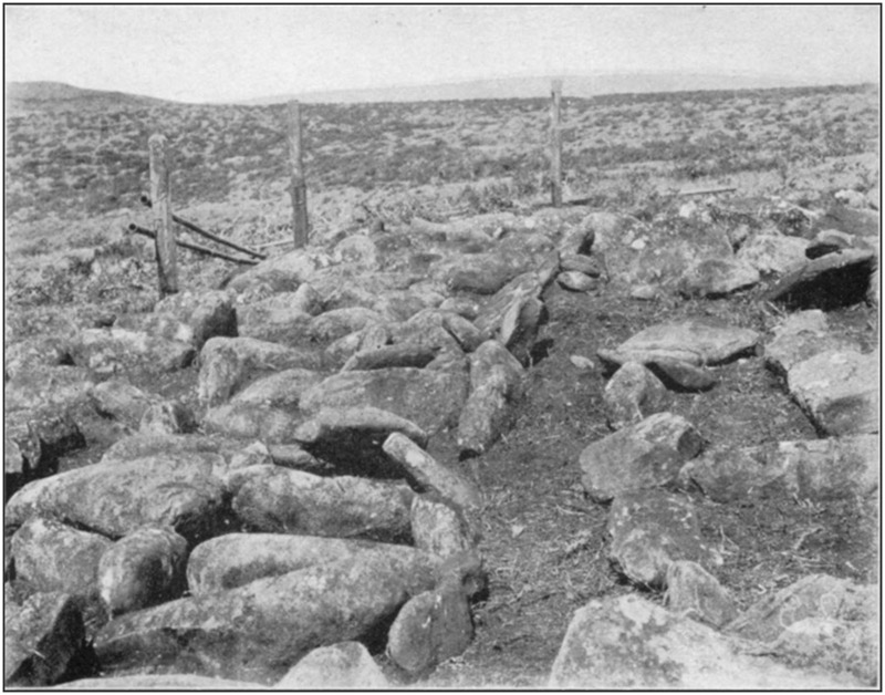
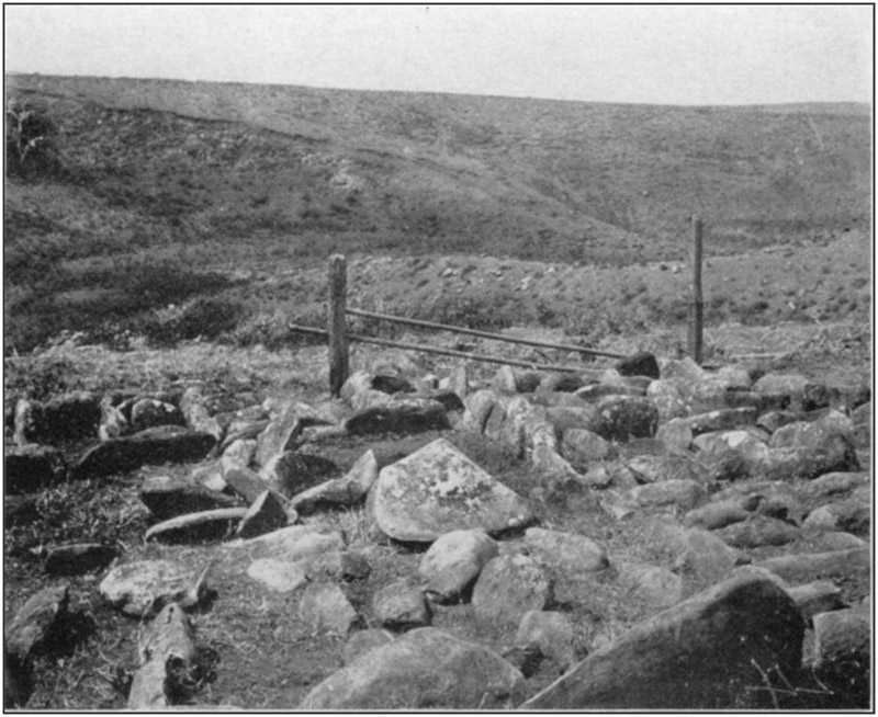
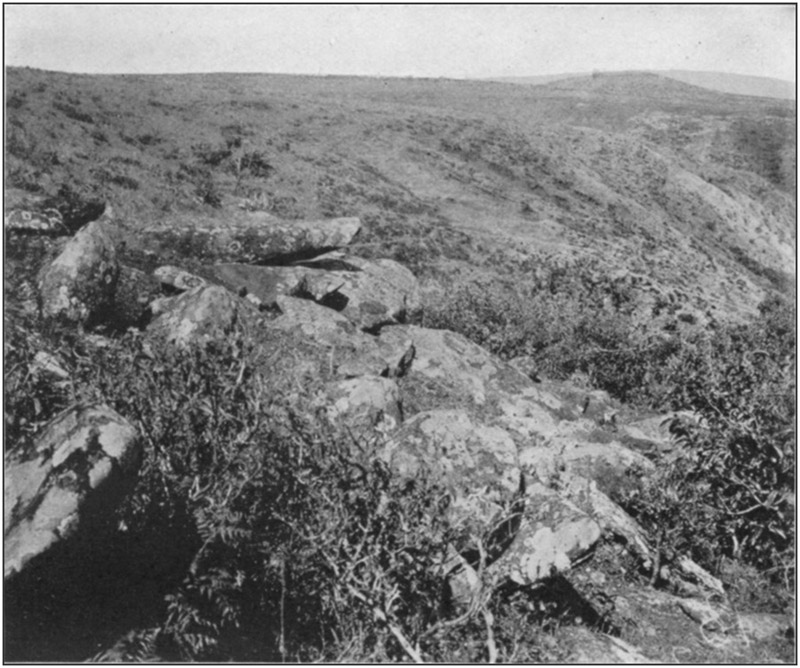
As it now remains, this heiau consists of flat stones placed on edge to make an inclosure 30½ by 20½ feet across the center, the length of the walls being 27½ feet on the north, 31½ feet on the south, 19 feet on the east, and 23½ feet on the west. At the middle is a minor inclosure, similarly formed, 5 feet 8 inches by 3 feet 8 inches, longest north and south. This is a kind of "altar" or "praying place." From it a narrow passage, 12 to 18 inches wide, extends to the middle of each side. In each of the four divisions thus formed other stones were placed to form box-like spaces of diverse shapes and dimensions from 9 by 15 to 20 by 28 and 15 by 45 inches. All the stones were set on the surface, braced against one another; no excavation was made to hold them. They have been somewhat displaced so that the exact number of the boxes can not now be ascertained, but there are somewhere between 110 and 120 of them.
Partial views are shown in plates 42 and 43.
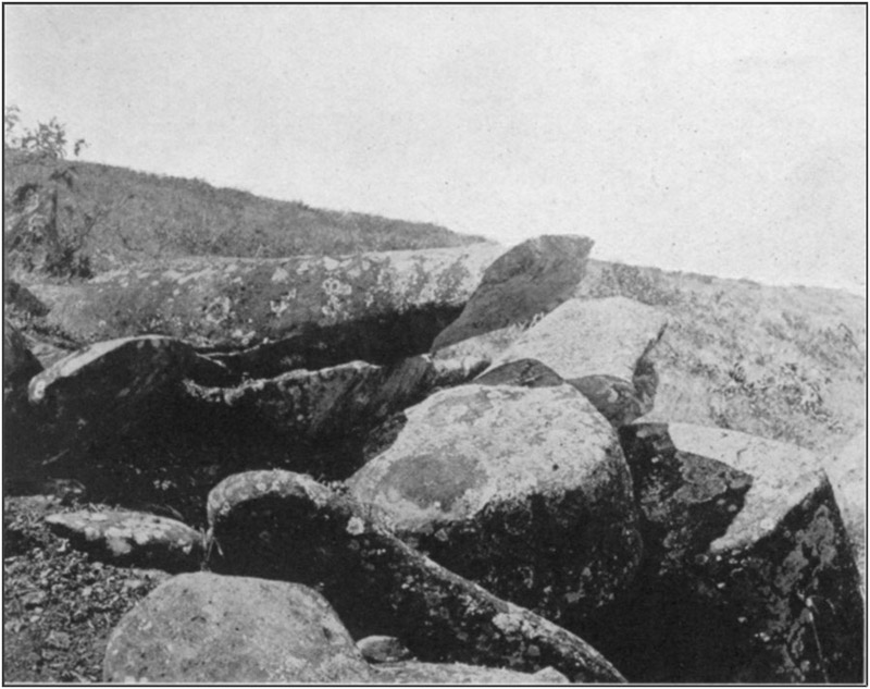
THE SACRIFICE STONES
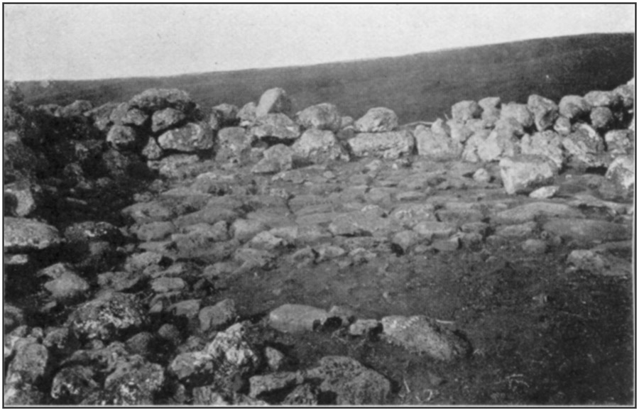
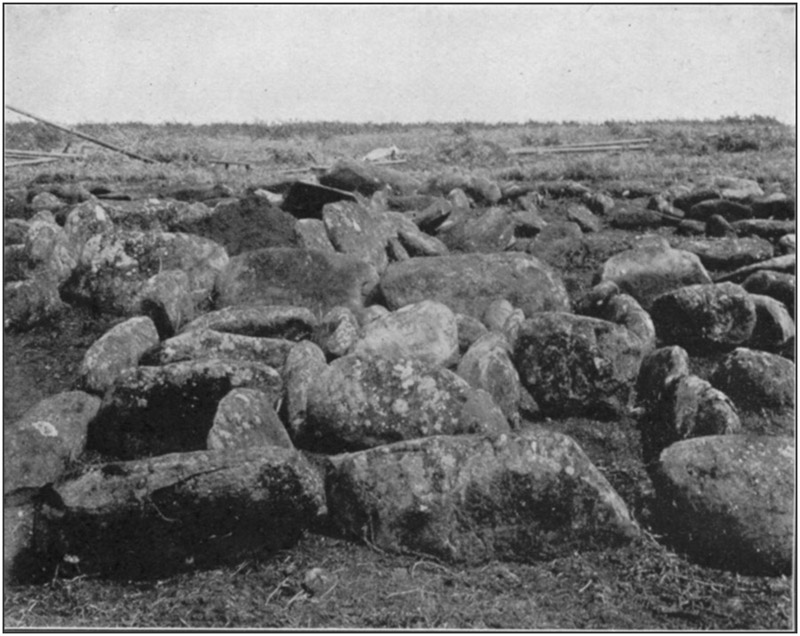
On the south side of a ravine with steep slopes and bowlder-strewn bottom, half a mile from the "Rain Heiau," is a pile of stones, most of them the natural outcrop, but some of them intentionally placed. The entire mass measures about 27 feet across each way. The highest stone is a weather-worn slab, with the upper surface somewhat convex, 6 feet 9 inches long, 2 feet 3 inches wide on the bottom, 1 foot 3 inches wide on top, 1 foot 4 inches thick. It lies nearly east and west, the upper end on the ground, the lower end on a large bowlder, beyond which it projects for 28 inches. Beneath this, with a space of 8 inches between them, is another stone, 5 feet long, 2 feet 4 inches wide, and 10 inches thick. Its upper surface is concave, the entire margin being higher than the central portion. It lies north and south, the southern end being supported by three small superposed slabs.
These two are supposed to be sacrificial stones, on which victims were extended at full length, face downward. In this position they were easily slain by being decapitated or the neck or head being broken with a club or a stone. That they were utilized for some definite purpose is evident from the fact that the projecting ends of both have been broken off square, the spalls splitting back along the under-surface.
Views are given in plates 44 and 45.
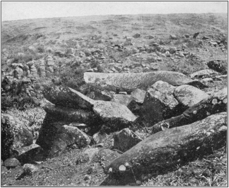
On the opposite slope of the ravine from the sacrifice stones are two old dancing platforms, made by digging the earth down on the [182]hillside to form a level area, the lower margin of which is supported by a high wall of heavy stones. Near the platforms, on the steep slope, is a space of a fourth of an acre surrounded by a stone wall; and a row of stones marks and preserves a trail or path from them to the bottom of the ravine, terminating at what seems to be a small reservoir surrounded by stones and earth, with a dam above and to one side of it to shut out storm water.
One hundred and fifty yards up the ravine from the dance platforms are two large artificial depressions in weathered bowlders. They have the appearance of mortars or nut-crushing holes, but are supposed to be for catching water during rains, as it is known that the natives made these miniature reservoirs or catch basins, the water being dipped out into vessels as it accumulated.
HAWAII ISLAND
There are reports of former heiaus, house sites, etc., in and around Hilo, and there are numerous so-called "caves," many of which were used by the earlier natives as receptacles for their dead. The term "cave" is not to be taken in its usual meaning of a cavity due to erosion by water, or the small recesses due to wind scouring. In the Hawaiian Islands it means a tube or tunnel; a hollow space due to gas expansion; or a hole formed by gas or steam expansion or explosion in the lava while it is still soft or flowing; and which is now accessible where the top has fallen in or where it has reached the face of a cliff. These still exist practically as they were at the time of their formation.
Of remains upon the surface, the clearing-up processes necessary for cultivation, and the improvements in and around the towns and villages, have either entirely destroyed them or so defaced them that they are now only shapeless ruins. Most or all of the near-by caves are in lava flows of comparatively recent origin and no reports of interments in them could be definitely verified. Human bones were found in three caves near Olaa, 10 miles from Hilo, but no objects of any sort were with them. The condition of the bones showed they had not been long deposited; in fact, with one skeleton were hobnailed leather shoes, with the bones of the feet still in them.
Three skeletons were discovered in a small cave near the dock in making an excavation for a railway cut. An old man living in the vicinity protested vigorously against any disturbance of them, saying they had been his friends and he had helped bury them. In deference to his sentiment the line of the track was deflected so as not to disturb the spot.
Nearly all of the bones mentioned above were soft and decayed, owing to the water which had percolated through the roof and dripped on them.
[183]
KILAUEA
It seemed probable that burials, or places where religious rites had been performed, might be found in the vicinity of the volcano. A number of caves were visited, but no evidence could be found to indicate that bodies were ever deposited in them, and persons living in that region had never heard of anything of the sort being found. A few of the caves were dry, but most of them were wet or have become obstructed by falling in of the sides or roof. Ledges and terraces within the ancient crater may contain graves, but lava flows and ash deposits have obliterated all traces of such if they ever existed.
WAIMEA
From 2 to 4 miles west of Waimea, on both sides of the road to Kawaihae, are numerous stone walls, house sites, garden inclosures, taro terraces, and other forms, of uncertain use and purpose. The remains extend over many hundreds of acres. It is said that up to about 1840 this was an important town, containing at one period about 17,000 inhabitants.
QUARRY ON MAUNA KEA
Waimea is the point from which to start for the quarries where the ancients obtained the hard black stone for making adzes. A great amount of work was done there, and refuse is abundant. It is 48 miles from Waimea to the quarries, part of the way by cattle trail through rough country, and they are at an elevation of more than 10,000 feet, considerably above the winter snow line. An examination was not attempted, as a visit to them involved securing a camping outfit and hiring guides and helpers at exorbitant wages.
KAWAIHAE
The "Great Temple" built by King Kamehameha I is on a bluff 100 feet high, separated from the beach by a low level space 100 yards wide. This flat contains many stone structures, but their number, design, and character can not be ascertained on account of the almost impenetrable growth of algaroba. One of them is a rectangle about 50 by 150 feet, the walls high and thick; probably it is an older temple. There is some modern work here, because in one place a wall is cemented, perhaps by ranchmen.
The "Great Temple" measures 80 by 200 feet on the outside, 50 by 150 feet inside, longest north and south. The two ends and the side toward the land are nearly intact and from 10 to 20 feet high according to the surface of the ground. At the north end, inside, is a platform 80 feet north and south by 45 feet east and west, the [184]four walls carefully and regularly laid up, the space within them filled with large stones, and the surface leveled with beach pebbles. It ends 4 feet within the wall next the sea, the top of this wall being on a level with the bottom of the platform. At the south end is another platform 40 feet east and west by 20 feet north and south, abutting against the east and south walls. A step or terrace 6 feet wide extends the full length of its north side. It has a less finished appearance than the platform at the north end. The central space, between the two, is paved with large stones which apparently pass under both platforms and extend from the foot of the east wall nearly to the west wall, a slight ditch separating it from the latter. The west wall stands below the top of the slope, and its outer face is from 10 to 20 feet high, in three platforms each 8 feet wide. On the slope below are several structures a few feet square formed by two parallel rows of stones with a cross wall at the lower ends, the cellar-like space thus inclosed being filled with pebbles to a level with the top of the walls.
From the northeast and northwest corners long walls extend northwest and southwest toward the beach. Their outer ends are lost in the thicket.
EAST POINT DISTRICT
From Kapoho southward to Kalapana and beyond many remains are reported, but residents say they are of rather modern date, some of them having been occupied since white people came into the country to live. Lava flows of recent date have covered a few.
NAPOOPOO
The large heiau at which Captain Cook made his landing, and where he allowed himself to be worshipped as a god, is about in its original condition, having been repaired in recent years. When Captain Cook attempted to seize the King as a prisoner, the natives naturally rallied to the King's defense. A stone or other missile struck Cook on the head.
Early in the last century an old Hawaiian who as a small boy witnessed the affray told Rev. Mr. Paris (as related by his daughter) that if Cook had been the god he pretended to be, the blow would not have hurt him; but when he fell with a loud groan the people knew he was only a man like themselves and, enraged at the deception practiced on them, quickly made an end of him.
HONAUNAU
The wall of the City of Refuge is nearly intact, as is that of the large heiau. Another heiau was destroyed by a tidal wave. The place is now a public park. Stokes, of the Bishop Museum, has done [185]much work here and at Napoopoo. The result of his labors will be published.
KEAUHOU
The "Slide," made here in the time of King Kamehameha I, consists of two stone walls from 50 to 75 feet apart, the space between them being filled with stones to provide a level surface from side to side and to equalize the slope from top to bottom. It begins a mile from the foot of the hill, and its terminus was on a level area near the coast. The lower end is now so displaced and overgrown for a fourth of a mile that it can no longer be traced; the remainder of it is practically intact. The slope is not uniform, being somewhat determined by the natural surface, so that it is steeper in some parts than in others. Near the upper end some short stretches are quite steep, presenting from below the appearance of terraces. In places, flat stones are laid pavement fashion from side to side, or rows of stones which seem to be the tops of walls extend across. These were probably to prevent crawling of the smaller material used as a leveler. The slide, according to an old Hawaiian, was covered with one variety of grass, on which was laid another variety; but he could not say whether the two layers had their stems parallel or crosswise. Kukui-nut oil was used plentifully to act as a binder and to give a slick surface. The "sliders," as well as he could remember the description of them, were like sleds with runners; not flat boards like a toboggan. Small depressions here and there, either basin-shaped or well-shaped, have led to excavations in the hope of finding something; but they are due only to falling-in of tubes, tunnels, or bubbles in the lava.
A somewhat similar but very much smaller slide is said to be on the coast 40 miles south of this one. At present it can be reached only from the shore, making a canoe voyage necessary.
Two ruined and overgrown heiaus are near the water line a mile from the slide. Both are built on bare lava, and at very high tides waves dash over them. Possibly the shore has sunk since they were built. Near by, on the flat lava, covered by every tide, are rock carvings rudely resembling the outlines of human figures. They must be of rather recent origin, as the stone is constantly subject to wear by the shingle. Stokes has copied them.
MOOKINI
At the extreme northwest corner of the island of Hawaii is a heiau in excellent preservation, there being but few fallen stones. The ground around is entirely free of growth except for grass and a few weeds, which may explain its appearance of newness; it has a very modern aspect, though it seems to antedate the discovery. It [186]measures 120 by 275 feet, longest east and west. The east wall is 11 feet high with a narrow terrace from end to end about midway the height. The north wall is 18 feet high. The south wall, which is in a somewhat irregular line, is 5 to 6 feet high. On the outside of the south wall, which forms one side of each, are two inclosures. One, near the east corner, measures 65 feet east and west and 15 feet wide, with its west wall at the edge of an opening which gives access to the interior of the heiau. The wall of this inclosure is 4 feet high. The other inclosure measures 21 feet east and west by 28 feet north and south, the west end flush with the west end of the temple. Its wall is 3 feet high.
The main west wall is 12 feet high. A platform 2 to 4 feet wide, probably a seat or bench, extends along the inside of the south wall. An interior wall 4 feet high, not straight but approximately parallel with the north wall, with a space 10 to 15 feet wide separating them, has one end against the east wall, the other end coming near enough to the west wall to leave only a narrow passageway.
The entire space inside is paved with large stones; on these, as a floor, are several walls whose purpose is not clear; they run in various directions. Near the west end are some small inclosures, also a raised platform in which are 13 "wells," said to be intended to "hold the blood of those offered up as a sacrifice." Possibly the bodies or bones of victims were placed in them, though it is more probable that they held posts or idols.
On the outside, 20 feet from the west wall, is a "sacrifice stone," 6 by 8 feet, averaging 15 inches thick. It is somewhat dished, with a natural depression 12 inches deep.
The heiau is about 200 yards from the ocean. Walls, like fallen fences, extend diagonally from the corners at the west end; the northern one terminates 200 yards away on an outcrop of lava; the southern one has about the same length and ends 50 feet from a similar wall that reaches in a rude semicircle, convex uphill, for 300 yards to the top of a cliff over the ocean. On the opposite side of a small cove within the farther end of this wall is a stone which is known to the natives as the "Shark" or the "Shark God." It is 8½ feet long, 32 inches across at the widest part, averages 14 inches thick, and has somewhat the shape of a coffin with narrowed ends. Lying just on the break of the slope, it inclines slightly down the bank. The end toward the water is carved in a fairly good representation of a turtle's head; on the opposite end are nine artificial cup-like depressions from 1½ to 3 inches in diameter with a depth rather less than half the width; three are on top, three on the end, three on the lower side. Like any long stone supported at the center with the ends free, it gives a metallic note when struck with a knife or other [187]small piece of metal. It is already defaced by curious experimenters, and will probably be broken up some day in search of the "treasure" inside, or to "see where the music comes from."
For nearly a mile south of the heiau, covering the space between the ocean cliff and a line approximately parallel to it a fourth of a mile up the hill, are many inclosures and long walls. Low walls surround spaces 10 to 15 feet across, filled level with earth, which are either house sites or burial places. Some inclosures, still smaller, with no break in the wall, are supposed to be graves; and graves may also be marked by the many small piles of stones. Other stone heaps, some straight, some crescent-shaped, from 10 to 20 feet long, all the curved ones convex to the windward, were wind shelters. Some of them are known to be made by modern hunters as blinds in plover shooting.
In at least two places are long parallel rows of large stones placed singly, 1 foot to 3 feet apart, the rows separated by a space of from 4 to 6 feet. One set has a dozen or more rows.
Inside of one of the inclosures, directly up the hill from the old landing, is a large stone with an artificial depression of 2 gallons capacity. It was intended as a mortar for pounding nuts.
LAUPAHOEHOE
An old lava flow has pushed out into the ocean in a shape somewhat resembling "a leaf floating on the water," which is the meaning of the word. It forms a nearly level area of 12 or 13 acres, only a few feet above tide. Toward the outer end are numerous walls and inclosures, mostly in ruins and overgrown with trees and bushes. Some of them are clearly modern; others are ancient. Near the lighthouse are the remnants of a heiau; only a part of its walls can be traced.
A wall 3 feet high, beginning at a large stone at one corner, incloses a space 26 by 27 feet, outside measurement; the interior is filled with earth and small stones to a level with the top of the walls. At the end toward the ocean, is a platform 20 feet wide, terminating 50 feet from the sea. On this platform is a space 7 by 12 feet, outlined by large rocks. Halfway between the platform and the water is a wall which may be recent.
Near this inclosure is one hexagonal in outline, the walls 2 feet high, and the space inside, 11 by 17 feet, filled with earth to a foot above the top of the wall.
On top of the bluff, 350 feet above tide level, is a heiau the west wall of which was removed in making a deep cut for the railway. The inside dimensions are 70 feet east and west, 115 feet north and south. The interior area, originally irregular, was somewhat leveled, [188]and covered with a pavement of cobblestones which were carried up from the beach, as were many of the large stones in the wall. The pavement has been torn up in cultivating the ground. The wall is from 4 to 6 feet high inside. This is a little more than the original height, as it was repaired and raised for use as a corral. Along the outside of the north wall, at the west end, is a heavy wall which, with the main wall, forms a "well," nearly filled with rocks. There are no supporting platforms outside, but along the north and east walls are revetments reaching halfway up the face. The southeast corner is rounded and braced or buttressed. These forms of support have been noticed in only one other place. There is a house site within, at the northeast corner. On the wall, placed there in adding to its height, were a broken taro pestle and a very dense siliceous rock, of high specific gravity, and filled with olivines. It weighs about 75 pounds. The ends have been chipped off to give it an ellipsoidal form, otherwise the wave-worn surface is unworked, except that one of its larger faces is rubbed smooth, almost polished, by use as a grinding stone, for which purpose it is excellently adapted by reason of its unusual abrasive quality.
MAUI ISLAND
There are not many aboriginal structures on Maui, but among those which can be found are some of extreme interest on account of their size and complicated arrangement.
KAUPO, OR MOKULAU
A mile and a half from the coast at Kaupo, or Mokulau landing, at the eastern end of the island, are two large heiaus. As it would have required a week's time and a considerable outlay of money to reach them, by reason of the distance and lack of roads, they were not visited.
WAILUKU
At the mouth of the Iao Valley, a mile north of Wailuku, is a sand dune having a nearly level area of about an acre at each end, connected by a curved ridge whose sharp crest is lowered about 20 feet by erosion. On each extremity is a stone inclosure, with several walls on the slopes below them except on the eastern side, toward the ocean. Here a stream has encroached upon the bottom of the dune to such an extent that only a portion of the inclosure nearer town is still remaining, one side and part of each end having fallen into the ravine. The wall along the opposite, or western, side is buried in the sand, only the highest stones still projecting. From the north wall a facing of large stones extending down the surface of the dune for a vertical [189]distance of 15 feet has prevented erosion by the winds. No protection was necessary below this point as the action of rain water on the lime from disintegrated coral rock contained in the deposit has caused the sand to "set" or harden.
The other heiau, at the north end of the dune, is apparently unfinished. None of it has disappeared, but the plan is difficult to make out. At its northern end is a protecting layer of stones reaching 25 to 30 feet down the slope, in three separate terraces. Similar terraces are on the slope below the southern end of the east wall. Here and there within the structure are well-like spaces filled with stones. The purpose of these is unknown. Stones of varying sizes, mostly small, within the walls indicate a pavement or floor, but the dense growth of lantana brush and the accumulated sand preclude any careful examination or accurate description of these remains.
WAIHEE
Southward from the mouth of the Waihee Valley, 5 miles north of Wailuku, is a range of sand dunes from 200 to 300 feet high, extending for half a mile or more in a wide curve, with the concave side facing the ocean. The level space thus bounded is about a fourth of a mile in its greatest width and contains 50 or 60 acres. Approximately parallel with the windings of the shore line, at an average distance of 200 feet from it, is a strong stone wall, built at an unknown date but prior to the advent of the whites. The plain purpose of this wall was to protect from high tides the low land lying behind it and reaching nearly to the foot of the dunes. This area is now cultivated in a variety of crops, mainly rice. Formerly it was a great taro patch of a Hawaiian settlement. A modern flume, which follows closely the line of an ancient ditch, brings down the necessary water from Waihee Creek.
In front of the wall a space of 5 or 6 acres is covered with a stone pavement on which are the walls of old houses and inclosures. They are protected on the seaward side by thousands of cubic yards of water-worn stones, piled up like a revetment or riprap, which terminate abruptly at the southern end but extend to the mouth of the creek at the north. The dunes show many angular rocks of the same general material, in their lower portion, so they all probably belong to a spur or projection from the mountain, washed clean at the front by waves, and covered at the rear by the dunes. Some of the stones along the water front were rolled by tides and wave-currents from the débris carried down by the creek from the mountains. At high tides waves surmount this natural breakwater, but spread out over the level pavement and sink between the stones, so that dwellers upon the site were not disturbed by their action.
[190]At its northern extremity the high wall connects with a rear corner of an extensive heiau, which was either never completed or has been partially demolished. The unfinished appearance of this, as of all similar remains, is explained by the natives as being due to the interrupted efforts at their construction by "the little people" (fairies), thousands of whom took part in the work. They must complete their task in one night; at the first gleam of dawn they must instantly disappear, leaving their work as it was at the moment, and could never gather at that spot again.
The highest part of the heiau wall still upright is about 10 feet; but some of the stones within, promiscuously heaped, are 2 to 3 feet higher. The structure is about 100 by 250 feet, longest on the line from water to hill. A cross wall, possibly somewhat modified in recent times, divides it into two unequal parts, the seaward portion being nearly square and 5 feet higher than the part at the rear. On the latter are small inclosures of stone, the space within them paved with gravel. If of the same age as the remainder of the structure they may have been for priestly seclusion or preparation, though they may be houses of later natives who took advantage of the foundation made by their ancestors.
Measurements or clear descriptions of these remains are not possible, owing to overgrowth. A satisfactory study, to distinguish between ancient and modern parts, or between undisturbed stones and those not in their original position, would require careful survey with transit and level after the brush is cleared away; and this must be followed up with considerable excavation as well as removal of loose rock; all of which would demand the labor of a dozen men for three months. Even at that, there is no certainty that definite knowledge would be gained; but it is not to be had in any other way.
BURIAL PLACES
Near the top of a remnant of a crater rising from the shore line of the ocean, 11 miles from Wailuku on the road to Kahakuloa, is a stone wall built on the leeward slope, the only place on which it could be constructed, as much the larger part of the crater has been blown out into the sea. Between the wall and the summit are at least a dozen stone-covered graves; possibly there are others not seen, as much of the brush is impenetrable. Some of them are sunken; others appear quite recent.
Many such graves are found on the dunes. They are all modern, some of them still surrounded by the original wooden fences.
[191]
IN THE IAO VALLEY
The deepest valley on Maui is that of the Iao River. The sides, nearly vertical in places, have an elevation of about 3,000 feet. About 2 miles above the town of Wailuku, well within the mountain, are walls made of stones of varying sizes up to half a ton or more. They extend over several acres of land and their structure is quite complicated. Mostly, they are borders of taro patches, though some of them mark house sites or garden inclosures. One wall, supporting a terrace, is 8 to 10 feet high and contains very heavy stones.
Near the head of the Iao Valley there are fully 40 acres of taro beds. A trail formerly led from this spot to the south shore of the island, near Lahaina. It can not now be traced, being obliterated by slides.
Residents of Wailuku say these places were in use only 50 or 60 years ago.
Many evidences of former occupation have been destroyed in operating the extensive sugar plantations.
KAUAI ISLAND
There seems to be less evidence of Hawaiian occupancy on Kauai than on any other of the five principal islands. Comparatively few heiaus are reported. Some of those which were in existence when the whites came have been destroyed or defaced to such a degree in establishing sugar plantations that their original form is uncertain; while others are so covered with vegetation, either natural or due to cultivation, that nothing definite can be ascertained as to their size or structure.
The site which might be considered as possessing the greatest interest is an aboriginal quarry and workshop where material for stone implements was obtained and shaped into desired forms. There can be no doubt as to the existence of such a place; but no one now knows its location, unless it be some of the older Hawaiians, who, however, profess entire ignorance in regard to it. Mr. William H. Rice, of Lihue, once induced some natives to conduct him to the spot. He believes that if he alone had gone his guides would have fulfilled their promise; but unfortunately several other men joined him, and the natives, either suspicious of their intentions, or not wishing the premises to become publicly known, pursued a devious and wearisome journey through the jungle, crossing gulches and clambering up and down cliffs until the white men were thoroughly bewildered and exhausted; then announced that they "couldn't find it," and led the party home.
[192]
LIHUE
At Niumahu, 2 miles from Lihue, on the road leading south and west from the harbor of Nawiliwili, is a fish pond known as Alakoka. It is a short distance above the mouth of the river, where the little valley widens in a half-moon shape, the stream flowing close to the bluff on the right. The bottom land on the other side is so low as to be swampy. Along the river bank on this side is a heavy wall of stone and earth, reaching the higher land at each end, thus forming a pond of 15 or 20 acres in which the ancient Hawaiians kept their surplus catch of fish. The wall has been raised and strengthened by its present owner, a Chinese, who raises ducks instead of fish.
WAILUA
Near the mouth of the Wailua River, 6 miles from Lihue, is the former abode of the royal family. The place is so overgrown, except in the few cultivated spots, that no examination of it can be made. No traces of the residences are apparent, although the stone boundary walls of the grounds are still standing. The site of the royal cemetery is set aside as public property. There is nothing now to indicate that any interments were ever made in it. The "Birthstone," on or by which all prospective heirs to the throne must be born in order to insure their right to the succession, still lies in the brush near the foot of a little cliff. In case of a dispute among the claimants to the throne this stone had the power, by some means of which the knowledge has now been lost, to determine which, if any, of the contestants was entitled to possession.
The "Sacrifice Stone," also, is in its original place, being so large that it can not be easily removed. Formerly this had a grass roof over it, supported by high poles. When the victim's life was extinct his body was suspended to a rafter or crossbeam at the top of the structure and left there until the flesh had decayed. The bones were then interred on top of the bluff in the rear. It is said that the corpses of chiefs and others of high rank were wrapped in banana leaves and steamed until the flesh fell away. The skeletons were then buried.
A mile from the mouth of the Wailua River, on a narrow plateau between it and a small tributary, the summit level being about 200 feet above the water, is a heiau in fairly good condition. It is one of the large structures of its kind, but is so overgrown that measurements or close description are not possible. It is supposed to be the one which was sacred to the devotions of the highest priesthood. The common people were not allowed to venture near it, and even the king could not visit it without special permission involving the most complicated ceremonies. It has passed into possession of the county and [193]will be restored as nearly as can be to its pristine state and thus preserved.
On a mass of loose rocks, resulting from disintegration of an old lava flow, projecting into the ocean half a mile east from the mouth of the Wailua River, and near the race track, is a heiau of irregular construction. The extreme measurements are 80 feet north and south by 200 feet east and west. The wall on the side toward the sea is higher and wider along the central half than it is nearer the ends. Small inclosures, bounded by single rows of stones, probably mark the sites of houses for priests and attendants. Along the inner side of the wall next to the water are four depressions, remains of partially filled well-like or cistern-like excavations; similar hollows, obscured by brush, are also next to the inner foot of the opposite wall. A large rock in the form of a triangular prism, standing upright, with one end firmly imbedded in the ground, was no doubt a "god" of some kind; it has a slight hollow or "cup" pecked in the flat top. There are several irregular rows of stones outside of the inclosure. Dense growth prevents the examination necessary for a closer description.
DUNE BURIALS
Four miles east of Lihue a spur of the plantation railway was run into the dunes to procure sand for making fills. In the course of this work human bones were found, the remains of one individual in one spot and of at least two others not far away. None of these bones seemed to have been long underground. Search in the vicinity, over bare spots among the ridges whose upper portions have been carried away by the winds, revealed indications of burials in at least six other places. Such bones as were found were decayed or in fragments. Among them was part of the skull of a very young infant. A quantity of cooking stones, some coral rasps or files, and a much weathered fragment of a wooden bowl, denoted that camps had been made on the dunes. As the beach is smooth, firm, and extensive, providing an excellent place for landing canoes or dragging seines, these remains probably pertain to parties or families who maintained fishing camps here.
At the mouth of the Wailua River, on the east side, was a "City of Refuge." It is now partially destroyed, many of the stones having been taken away to make a fill in the road. It was rectangular in form, 360 feet east and west, 60 feet north and south, made of large stones, some of them weighing a ton or even more. The eastern portion of the interior is artificially made a foot higher than the western. The structure is 300 feet from the water. Midway down the gentle slope in front, opposite the western end, is a slightly crooked row,[194]100 feet long, of very large stones. A similar row is near the water on the side between the inclosure and the river.
WAIMEA
There were formerly several heiaus within a few miles of Waimea. Some of them have been destroyed by cultivation, while others are difficult to find and impossible to examine in the cane fields or dense brush.
At the east foot of a rocky peak 13 miles by road from Waimea, at an elevation of more than 3,600 feet, is a small heiau almost on the brink of the canyon. Within the walls it is 30 feet across each way. On the south line are three large stones in line, one at each corner, the third about midway between them. No doubt their position determined the location of the structure. It stands on a slight slope. The west wall is 2 feet high inside, the earth having washed down level with its top outside. The north wall is a foot higher than the floor at the west end, and is completely buried at the east, as are the south and west walls along their entire length except for a protruding stone here and there. In fact, the whole interior seems to have received a heavy deposit of earth, carried in from the outside by wind and rain. All these features give an appearance of antiquity to the ruin.
Directly below it, well toward the bottom of the canyon, which is said to be 3,000 feet deep, is a long, narrow, curved ridge with rounded top and almost vertical sides. The upper part, apparently an old lava flow, is darker in color than the surrounding precipices, its surface checkered and seamed by weathering and erosion, so that it has an almost startling resemblance to a huge serpent crawling out of the side of the mountain and, with head laid flat on the extreme point of the cliff, watching something in the stream bed a thousand feet below. If the old Hawaiians had been familiar with ophidians, as were the American Indians, this "Snake God" would no doubt have held high rank among their divinities.
CONCLUSIONS
As intimated above, much additional information regarding antiquities in the Hawaiian Islands can be found in publications of the Bishop Museum in Honolulu. Descriptions, with illustrations, of a number of heiaus are given by Mr. Thrum in the "Hawaiian Annual" for 1906 to 1910, inclusive; and his forthcoming volume will completely cover this branch of archeology. The Bishop Museum has undertaken to make a complete survey and report of all the ancient remains, while Dr. Brigham has almost finished for publication an exhaustive treatise which will include all his observations [195]and deductions along the same lines. With these tasks ended, there will be nothing for anyone else to do, except to take measures for the restoration and care of the principal structures.
All the aboriginal remains on the islands are the work of the present Hawaiian race. When the earliest of these people came here they found the islands without inhabitants. There are no evidences of any prehistoric population nor any indications whatever of underground remains. Consequently, so far as can be ascertained, excavations would not result in the discovery of any prehistoric objects or of anything essentially different from what can be seen on the surface or found slightly covered by very recent natural accumulation. At the same time, all the remains are well worthy of study and preservation. These conclusions meet the full approval and indorsement of both Mr. Thrum and Dr. Brigham.