Showing posts with label Indiana. Show all posts

Monday, June 16, 2025

8 Ancient Nephilim Giants Buried Like a Sun Wheel in Walkerton, Indiana Mound


8 Ancient Nephilim Giants Buried Like a Sun Wheel in Walkerton, Indiana Mound

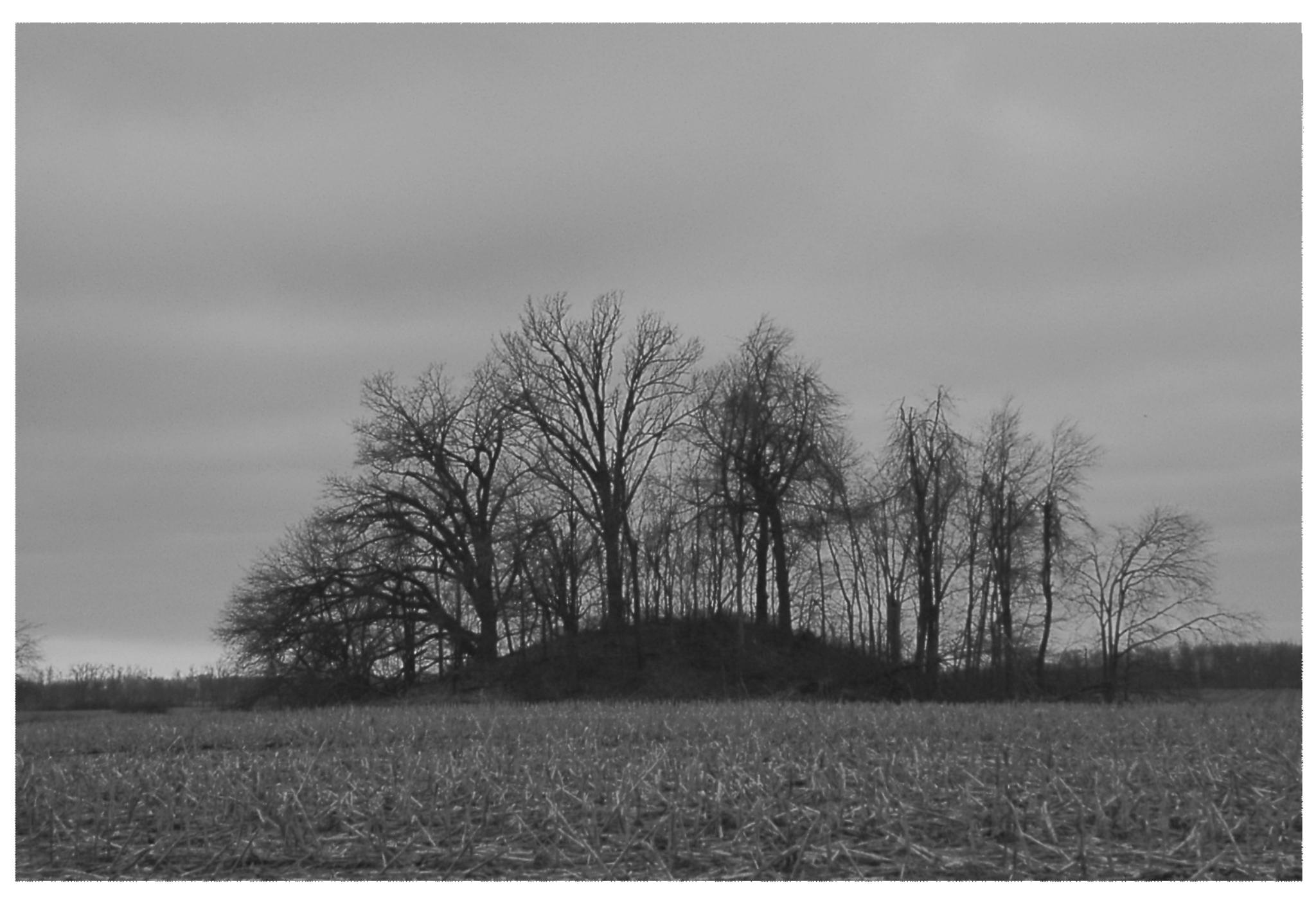
Remnants of this mound were still visible a few years ago before being completely destroyed by university grave robbers.

The News, October 23, 1925
MOUND GIANTS IN INDIANA SAID TO ANTEDATE INDIAN
   South bend, Indiana - Eight skeletons, one of them clad in copper armor, and a heard of rare war weapons and bits of personal adornment have been found in a mysterious mound on the farm of Grove Vosburg near Walkerton.
Vosburg, a 70-year-old farmer, had long desired to know the secret of the mount, which, according to local tradition dates back thousands of years. Secretly excavating the pile of earth, he came upon a strange burial place.
Giant Skeletons
    The eight skeletons lay in a circular formation, arranged like the spokes of a wheel, with skulls together.  Copper breastplates, bands and other bits of armor adorned the skeleton on one man, who apparently had been of giant stature.  Embedded in this skull was a beautifully chipped arrowhead.
The soft earth of the mound revealed other treasures. Three pounds of ore believed to be either silver or white gold, lie with the bones. There were corroded copper bands, which antiquarians here believe were used to bind war clubs, two pipe bowls, one of smooth black stone and the other carved replica of a fantastic monster, were found.
   The belief that the bones are not those of Indians but belonged to the ancient and little-known race of mound builders has arisen because of the great size of the bones and the fact that the skull formations are not those of the Indian types.  The skulls seem to have little forehead, and the eye cavities are high in the head.


Monday, May 12, 2025

Indiana Ancient Burials Mounds and Earthworks Map

 Indiana Ancient Burials Mounds and Earthworks Map


I physically investigated about 400 burial mound and earthwork sites in Indiana. I was able to find and photograph eighty-five burial mounds and earthworks. Only four of them are recognized as historic sites. Most of these would date from 800 B.C. - 200 A.D.

For photos, histories, and directions to these sites and 130 more in Ohio, Kentucky, and West Virginia.


Thursday, May 8, 2025

Large Mandan Skeletons Found in Indiana Stone Tombs on the Ohio River

Large Mandan Skeletons Found in Indiana Stone Tombs on the Ohio River

Sioux-Mandan Indians, when first discovered, had blonde and red hair with blue and green eyes.

Washington Post, October 27, 1912, 50 Giant Tombs Discovered in Jeffersonville, Indiana believed to be Kings Tombs. “Not one less than six and one half feet high

   One of the best-known archaeologists of Indiana, Dr. W. F. Work, of Charlestown, Ind., found seven similar stone tombs 13 miles from the scene, and he noticed that the left temple of each dead man was crushed in and that the bones were those of men of gigantic stature. Dr. Work spent much time in exploring the inhabitants of the cliff dwellers of Arizona and has written much on the subject. He believes Yellow Hair’s people were the Mandan Indians. Orlando Hobbs, also an archeological authority of Indiana and a man known widely for his learning and research, holds this opinion.”

Saturday, May 3, 2025

Who Destroyed the Ancient Breckenridge Creek Indian Burial Mound in Fort Wayne, Indiana?

 Wonder who destroyed the Ancient Breckenridge Creek (Purdue Campus) Indian Burial Mound in Fort Wayne, Indiana?

On the left is my photo of the Breckinridge Creek Indian burial mound taken in 2010. I took the photo on the right in May 2025. Who excavated this burial mound? Purdue University, where the mound is located?  The burial mound is visible from end of the bike path on the Purdue campus.


History of Allen County, Indiana 1880

 "Still further down the river, on the east side, at the mouth of Breckenridge Creek, is a single mound, which has not been opened except a slight excavation in its side, which developed the customary lumps of charcoal. This point is about four miles north of Fort Wayne and is the most southerly point in the county at which mounds and earthworks are known to exist."


Sunday, September 1, 2024

Indiana, Kentucky and Tennessee Shell Mounds Determined to be Early Sioux

 Indiana, Kentucky and Tennessee Shell Mounds Determined to be Early Sioux


The Crib Shell Mound is upriver from Bone Bank in Posey County that was determined to be of Siouan origin. Hopewell mounds and earthworks, like the Mann site in Posey County, are definitive evidence of Sioux origins of the Hopewell mound builders.


    In Louis F. Burns book “The History of the Osage” he writes, “Recent archaeological findings seem to indicate that both the Dhegiha Sioux and Chewere Sioux were the Indian-Knoll and Shell Mound culture of [Indiana] Kentucky and Tennessee.” Skeletal remains found in these shell mounds are identical to the later Hopewell showing that they had inhabited the Ohio and Wabash Valleys for hundreds of years.  


Saturday, August 24, 2024

Ancient Indiana Travel: Six Ancient Sun Temples (Henges) in Indiana Dating 500 B.C.- 200 A.D.


Six Ancient Sun Temples (Henges) in Indiana Dating 500 B.C.- 200 A.D.

Ancient Indiana Travel

  There are eighty-five burial mounds and earthworks in Indiana! Only three sites are registered as historic sites or preserved. Most notable are the three henge complexes made to align with the sun, moon, and bright stars in New Castle, Cambridge City, and Mounds State Park in Anderson.
They date as early as 500 B.C - 200 A.D. The same people constructed the rectangular enclosure in Winchester to align with the solstices that created a Pythagorean triangle within the work. Indiana archaeologists reported this with another Pythagorean triangle formed in the spacing of the Newark, Ohio earthworks and recognized by Brad Lepper, curator of Archaeology at the Ohio History Connection. Near the Winchester work was another square earthwork at Fountain City that was constructed to be numerically harmonic with the lengths of the walls at Winchester. Winchester's east-west earthen walls were 1320 feet, and the north-south walls were 1080 feet. Fountain City consisted of four 780-foot walls. 1320 - 780 = 540, 540 + 540 = 1080.  Knowledge of pi, squaring circles, geometry, trigonometry, surveying...these people's math was as advanced as the rulers of Babylon from 2,000 B.C. - 1600 B.C. called the Amorites. They were one of the giant tribes accounted for in the Bible. 
    When you visit the earthworks, you will know that they are far more than piles of dirt.
    I believe the Amorites were the Adena mound builders. I think the Dakota Sioux were the Hopewell mound builders. The advanced mathematics used in constructing the geometric earthworks is not of Native American origin. Building henges as astronomical calendars are identical to those found in the British Isles with Amorite origins. In England, we have conical burial mounds surrounded by earthwork or moat, and we also find it is a type of burial mound in the Ohio Valley. There are too many similarities to suggest they are independent of one another. 
   Political correctness is the driving force behind the narrative of universities. Only recently have the universities acknowledged the Pythagorean triangles with the doctrine that if you believe the Native Americans didn't figure it out, it is deemed racist.

1.) Mounds State Park, Anderson, Indiana Burial Mound and Henge Complex
        There were ten henge groups in Indiana, Ohio, and Kentucky. The best preserved is Mounds State Park. The Great henge was constructed to align with the solstices and bright stars. The burial mound in the center of the henge's platform was aligned to the solstices for two thousand years before being destroyed by university archaeologists ignorant to its importance as a solar marker. Two earthworks are still visible but not marked by the park. 


The importance of the burial mound in the central platform is visible in this map of the henge's alignments. Universities destroyed the mound: they should rebuild it. The small work aligned to Fomalhaut is still visible but not marked. The outer wall has dips like a great serpent surrounding the central platform, these dips were made to align to stars and the solstices.

The importance of the burial mound in the central platform is visible in this map of the henge's alignments. Universities destroyed the mound: they should rebuild it.
   A henge is described as an earthwork with an interior ditch and an outer wall with a gateway that is generally aligned to a solar event. (This is an exception). The deep ditch initially held water.

To the north of the previous henge is this panduriform shaped henge that is aligned to the May 1 Beltane sunrise. The sun will also set on the gateway to the west on October 31.


2.) New Castle, Indiana Burial Mound and Henge Complex
 
    Despite Ball State University all but destroyed the jewel of Indiana's antiquities, which was the loaf-shaped burial mound surrounded by a deep ditch. Most of this burial is gone except for the ditch that surrounded it. There are still four henges visible, along with two burial mounds. This site is on public land but is not preserved or recognized as a historic site.
    
New Castle, Indiana henge complex.

You can only see the remnants of this mound and earthwork site in winter when the high grass has died. The ditch around the large mound is visible, along with the henge, a burial mound to the west. To the south, in the woods, three henges can be seen. 

This is the large loaf-shaped burial mound oriented to the east with a surrounding earthwork and ditch (much like a henge) before Ball State University archaeologists all but destroyed it. 


I am standing in the middle of the now-destroyed burial mound, looking west on the Equinox when the sun aligns with the two burial mounds. You can see the surrounding ditch in the foreground.

To the west of the loaf-shaped burial mound were two henges, one easier to see than the other. The outer walls of the henge are highlighted in the photo. One of the better-preserved henges is to the south.


Also, in New Castle, Indiana, this single henge has a gateway aligned to the winter solstice sunrise. The henge is located next to the High School in a public park.

Cambridge City, Indiana Henge Complex

    The Cambridge City Henge Complex has been plowed for a hundred years, yet the largest henge is still visible in cultivated fields. Originally, the southern henge was the same dimensions as the Mounds State Park henge at 210 feet in diameter. 
     It is hard to define, but the southern henge's gateway is a little north of east and may have been aligned to the May 1, Beltane sunrise. 
     One interesting feature at the site was a cut made in the earth to make a graded way that led from the center of the two henges to the creek below.
    Three major henge sites in Indiana, all within twenty miles of one another, make this the henge capital of the Ohio Valley. That only one is being preserved shows that Indiana needs to be made aware of the economic value of having these prehistoric remains utilized as travel destinations. 


The Indiana Geological Survey did this map of the Cambridge City works in about 1915. The original map shows that the southern henge was aligned to the east and the northern henge to what appears to be the summer solstice sunrise. Between the two henges you can see where the cut was made that lead down to the West Branch of the White River.

A LIDAR photograph of the site reveals that the southern henge may align with the May 1 Beltane sunrise. The Beltane alignment also occurs at the North Panduriform henge at Mounds State Park. The LIDAR image reveals that the northern henge was not circular in shape but a panduriform. The gateway appears to be aligned with the equinox sunrise. There are as many as thirteen smaller earthen circles at this site.

This photograph was taken on the cut's western side, looking east towards the earthworks. The sacred way connected the sun temples in the upper world to the water in the lower world. This geographical aspect also occurs at Mounds State Park and New Castle, where the burial mounds and henges were built on high bluffs overlooking a river. 

This is what the southern henge looks like today. It is still an impressive ancient sun temple.

Yorktown Indiana Henge

    A history of Delaware County mentioned in 1881 that near Yorktown, there was "one of those enclosures … of the class know as fortifications." I went to this site in or about 2006 and talked to the landowner, who complained that Ball State University archaeologists were trespassing on their land without even asking permission. They would have been given permission had they asked. Instead, they were asked not to return.
  Ball State archaeologists wrote in their report, "The site retains integrity and is one of only two surviving examples of isolated circular enclosures in east central Indiana."  Another isolated henge in Delaware County was destroyed by farming. A single henge still exists in New Castle, Indiana, and another in Allen County, Indiana.

Yorktown's henge gateway is aligned with the summer solstice sunrise. This is the first earthwork that the Archaeological Conservatory purchased." This is good since Indiana has no plans to preserve anything.

The interior ditch of the henge holds water as it was originally intended to do.

Fort Wayne, Indiana Henge


The henge is located north of Fort Wayne on the St. Joseph and is the northernmost of all the sun temples. I was at this site on the Equinox sunrise, and there was no alignment that I believed would line up on the Beltane sunrise of May 1.  Three other henges in Indiana and Ohio have this May 1 sunrise alignment that hints that a Celtic people once inhabited these regions.


Monday, August 19, 2024

The Desecration of Oneota Sioux Burials by Indiana (IPFW) Fort Wayne Archaeologists

 The Desecration of Oneota Sioux Burials at Strawtown, Indiana by (IPFW) Fort Wayne Archaeologists

"I would say in general," Sutter said, "I don't think anybody who has knowingly violated NAGPRA regulations should be permitted to work as an archaeologist at a minimum.”
More on the evidence that the Strawtown site was of Oneota Sioux Hopewell origins  www.nephilimgiants.net : Strawtown Hopewell Earthwork Determined to be Oneota Sioux in Central Indiana

The archaeological dig at Strawtown, Indiana, was extensive, leaving a wake of destruction on this ancient Oneota Sioux burial and earthwork complex. Archaeologists found a copper headdress at the site with skeletal remains that are diagnostic of Middle Woodland Oneota Sioux Hopewell dating 300 B.C. - 500 A.D.   Oneota Sioux Hopewell have been recognized across Indiana from the Mann Site in Posey County to the Porter County in northwest Indiana. I know of no skeletal remains that have been returned to the Oneota Sioux. If archaeologists recognized the Dakota Sioux as the builders of burial mounds and earthworks in Indiana, they would be forced to empty their vast collections of artifacts and skeletal remains.  
    In Indiana, the greatest threat to the ancient burial mounds and earthworks is the presence of university archaeologists. When will the government finally defund the universities?

These are excerpts from just one of the articles that detail the university archaeologists' crimes at Strawtown, Indiana. 


How a Native American burial site was desecrated in Hamilton County
County, university officials aggressively excavated ancient burial site at Strawtown Park, trampling on rights of tribes to protect their dead
Chris Sikich

chris.sikich@indystar.com 11/5/16 Full story here 
Eternal unrest: How archaeologist, Hamilton County park officials defiled Native American graves (indystar.com)

"The first summer archaeologists began excavating a Native American burial ground at Strawtown Koteewi Park, they found a human jawbone.

The law was clear. They should have notified Native American tribes to allow them the opportunity to rebury their ancestor.

Instead, they studied, cataloged and boxed up the bone fragments. And for the next 10 years, Indiana University-Purdue University Fort Wayne's archaeological team and the Hamilton County Parks & Recreation Department continued digging aggressively — never notifying tribal leaders.

"What happened is awful," Richard Sutter, the head of IPFW's anthropology department, told IndyStar. "It's inexcusable."


"Andrew Smith and Craig Arnold, two of McCullough’s assistant archaeologists, said they excavated entire structures, in many cases leaving nothing untouched. They dug so extensively that future archaeologists who might have new technology will not be able to reinvestigate certain sites. Procedure calls for no more than half of structures to be excavated and they took so many artifacts from the ground, it left little money for analysis."

"Karin Maloney, an archaeologist who worked as a history interpreter for the park from 2006 to 2012, said she told McCullough and Patterson the excavations were violating NAGRPA within a year of being hired."

They did not stop until they uncovered a skull. They found a copper plate beneath the skull, indicating a person of status.

"I would say in general," Sutter said, "I don't think anybody who has knowingly violated NAGPRA regulations should be permitted to work as an archaeologist at a minimum.”

Arnold and Smith began working with the tribes, a collaboration that ultimately led to a list of 90,000 items that were found in graves, near human remains or within sacred sites.

Each new revelation over the next several years — from the fact human bones and grave offerings had been excavated, to the discovery that thousands of children had participated in digs at grave sites — heightened the outrage of Strack and other tribal representatives.

"The idea that uninformed, untrained children were participating in the excavations, pushing dirt through screens, was unthinkable," Strack said. "That could be the decomposed remains of our ancestors."

By November 2012, three tribes had filed federal complaints.


Even then, they did not file a report with the NAGPRA office.

Instead, McCullough removed the pottery, which is now thought to be a burial vessel. A significant find, it was the first artifact to link an early Great Lakes culture called the Oneota to Central Indiana.


Sunday, August 18, 2024

Adena Burial Mound in Vigo County, Indiana?

 Adena Burial Mound in Vigo County, Indiana

This burial mound looks to be of natural origin. It may as the history suggests being "topped out."  There are many man-made burial mounds near this possible burial mound.

  Indiana Geological Survey 1896
   In the S. E. Corner of Section 29, Prairie Creek Township, there is a hill or mound about fifty feet high which seems to have been a point of the bluff that was topped out by the mound builders and used as a signal station.


Saturday, August 10, 2024

May 1 Beltane Sunrise and October 31 Samhain Sunset at Mounds State Park, Anderson, Indiana

May 1 Beltane Sunrise and October 31 Samhain Sunset at Mounds State Park, Anderson, Indiana

 The north henge at Mounds State Park will be the third earthwork in the Ohio Valley to be aligned with the May 1 Beltane sunrise and the October 31 Samhain sunset.  

In the history of Madison County, Indiana, the north henge (Circle Mound) orientation was measured at 67 degrees North. Their map of the earthwork clearly shows that it is not on an east-west axis. Why are the docent archaeologists at Mounds Staye Park claiming that the gateway is aligned to the equinox sunrise?


History of Madison County, Indiana, 1880


 “On the same section of land, but a half mile farther up the river, and on the same side of the stream, there is another cluster of earthworks that are of nearly equal interest; in fact, the principal work A, on plate K, is, in some respects, more remarkable than the large circle on plate E. The outline is of irregular shape-constricted on one end and at the sides; at the other end there is a gateway (D) 9 feet wide, protected by two small mounds (B) and (C), now about 4 feet high. The wall is 30 to 35 feet wide at the base, and about 4 feet high; ditch 8 feet wide. A central line through the longer way is north 67 degrees east and 296 feet long; it is 160 feet across at the widest and 150 feet across at the narrowest part--near the middle. With the exception of the two mounds at the gateway, which lie on the cultivated side of a section fence, and have been cut down by the plow, the remainder antiquity is in as good state of preservation as when deserted by its original occupants. Large trees are growing over it, and the underbrush is so thick that it was difficult to obtain accurate measurements; in fact, there is hardly a stick of timber amiss over the ruins.”

Wow, the DNR archaeologists claimed an equinox sunrise alignment at the henge. Why are there no photos? I read from a university archaeological department that this henge and gateway were aligned with the equinox sunrise. I had dismissed this work as a possibility for aligning with the May 1  - October 31 sunrise and sunset.
   After finding a website that gave the angle of the sunrises and sunsets, the old histories of these measurements could be deciphered. The people working for the DNR at Mounds State Park are nice and very knowledgeable on the grounds. They got some bad intel from our experts at one of the universities. 
On May 1, at Mounds State Park the sun will rise at 69 degrees N.; it will be at 68 degrees by the 3rd and 67 degrees by May 6. Earth wobble over two thousand years accounts for the discrepancy. When I photographed the May 1 sunrise at an Ohio Henge the sun rose visibly on the gateway. The actual alignment was May 5, so few days discrepancy is accurate. It will" appear" perfectly aligned on May 1; then, on October 31, you can stand outside the gateway looking west, and the sun will set in the gateway once flanked by two mounds. The place to be on Halloween dusk!!!

In the History of Madison County, Indiana the earthwork was aligned to 67 degrees north.

According to timeanddate.com (graph above) the earthwork's eastern gateway will align to the Beltane sunrise.

On October 31 the sun will set in the west and align with the henge's eastern gateway.


Ancient Celtic Druid's Temples in the Ohio Valley


Saturday, August 3, 2024

Adena Burial Mound in Ripley County, Indiana

 Adena Burial Mound in Ripley County, Indiana

Since the previous history a tomb was built inside of the mound, removing parts of the eastern side. This is just one of 85 burial mounds and earthworks in Indiana. Visit and preserve Indiana's ancient history.


“Indiana Geological Survey,” 1875

“An earth mound of considerable dimension is situated in the cemetery of Versailles.”


Friday, August 2, 2024

The Winchester, Indiana (Randolph County) Adena Giant's Earthwork. Constructed Using the Pythagorean Theorem

 The Winchester, Indiana (Randolph County) Adena Giant's Earthwork. Constructed Using the Pythagorean Theorem

According to Indiana archaeologists the Winchester earthworks were constructed using the Pythagorean theorem.  It is of interest that the earthworks at Newark were spaced also using the Pythagorean theorem. 
  This is a short video that highlights all of the mathematics used in the construction of the Newark Earthworks. The Pythagorean theorem, Pi, and square roots of numbers were all employed in the construction. 
    When Native Americans (Algonquin, Indiana) were asked about the earthworks in the early 1800s, they shrugged and said they were there when they arrived in the area.

    Brad Lepper in a talk about the Newark earthwork admitted that the Pythagorean theorem was used in the layout of the large henge and the circle and octagon. He reasoned that not believing that the Native American knew the theorem was racist. There is no evidence that Native Americans had any kind of advanced mathematics. There legends suggests that a foreign people had come to North America and had built the mounds and earthworks in the Ohio Valley.


Randolph County's Largest Ancient Adena Mound

 Randolph County Indiana's Largest Ancient Adena Mounds

This Adena burial mound is one of three of these large mounds that once were within a mile of one another. To the north of this mound is the small town of Snow Hill whose namesake is from a now destroyed mound. 


“Concerning a Burial Mound Recently Opened in Randolph County” by Joseph Moore

From Proceeding of the Indiana Academy of Science, 1894

    Besides a number of well-defined made mounds in the neighborhood of Lynn Station on the G.R. & I. R.R. there are frequent examples of natural mounds. These are usually much larger than the artificial mounds. They may be compared to drift islands surrounded by flat areas of dark colored soil. Ancient peoples as burial grounds have utilized some of these mounds of modified drift. The one of which I speak is a fraction over a mile west of Lynn Station. It is about 150 years in circumference and eighteen to twenty feet high and is so symmetrical as to have the appearance of a made mound; but in a wide cutting made through it by the gravel haulers the structure clearly shows an aqueous deposit from top to bottom. In this mound the workmen say they have opened “more than a hundred graves.” They “counted till they reached seventy.” Quite a number of the skulls were sufficiently preserved to bear handling, even after being for a short time exposed to the air. Some of them on being treated with a solution of glue have rather a fresh, recent look. Very many of the bones were broken to crumbs by visitors in sport. Some of the skeletons were in a sitting posture with the chin crowded upon the knees.

The depth of the graves was from a yard or less to twelve feet and more. The skeletons were of both sexes and various ages, some quite young. It was alleged that a horse’s bones were found, but I was unable to find the least scrap. They also tell of a dog’s skull with the teeth all perfect. This is possibly so, but it would seem more likely that it was the head of a wolf, which is quite similar. Quite a number of implements were found some of which are here on the table. One skeleton was found with a large dart in each hand.

They assert that a scapula was found pierced by a flint dart and that the dart was lodged in said bone, but that the bone immediately crumbled from about it. There were beads of bone, shell and copper (but few of the latter) copper rings, tube pipes and various other things, the uses of which are not very well known.

You will see in the skulls presented for your examination that there is quite diversity. Two of them are of the brachycephalic or short-head type, one barely so, the other extremely so. The one has the lateral diameter in the proportion to the fore and aft, as 86 to 100, the other 92 to 100. The others are all orthocephalic, though one of them approaches to the longhead type.

You will note not only the extent to which the teeth are worn, but also the peculiar manner of the wearing. It will also be seen that decayed teeth, caries of the bone and also signs of gumboils and abscesses are not confined entirely to civilized races.

The upper wisdom teeth in one of the skulls show, each, examples of enamel tubercles on the fangs, a rather rate phenomenon, as I understand.

You will note also in one of them an extraordinary double suture at upper border of occiput. A question of interest: Did such diverse skulls belong to the same tribe, or did different tribes at different times bury in the same grounds?